
On August 13, we delayed leaving Long Beach until 9 a.m. in
order to allow most of the craziness of business traffic to lighten. We were near the coast and headed west on the
91 before taking a north-easterly direction to Las Vegas, where we spent a night
at a casino resort and campground I like to go to. For the record, I do not like driving on the
California freeways and byways. The natives pass you on the shoulders, cross
over four lanes to make an exit, hug your bumper at high speeds, and slow down
to stop suddenly in front of you, all the while texting and applying eye
makeup. We got out of the major
congested areas without too many full stops on the five-lane roads. I needed
diesel and would not be able to cross the state border before I ran out. My goal was to refuel as close as possible to
the Nevada state line to reduce the cost. California prices were $4.65/gallon. Using the app Gas Buddy, Daisy found some for $4.25, but we only got enough to
get us to our destination. We arrived in
Las Vegas about 5 p.m. and checked in at the Sam’s Town RV Park and Casino.
This was Daisy’s first visit to this casino, so we walked around and found a
good place to dine. After dinner we played a poker machine, or rather Daisy
did. She put in $1.00 and got back $6.25 for an hour of entertainment. Daisy
knows how to play the game--I must ask her more questions about her former life. We then watched a light show and danced to a
good country western band. This was an
enjoyable way to end the day.
 |
| $18 for a full hook up site with several eating places handy |
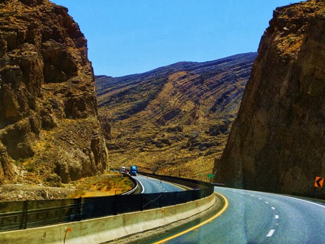
We left Las Vegas on the 14th heading northeast.
Our final destination on this return trip was our house in Arkansas. We traveled
via the National Parks of southern Utah, then made additional stops in
Colorado, Wyoming, Nebraska, and Kansas.
It was a little difficult to decide which of the five Utah national parks to
visit, so we did them all, with Zion NP being the first.
This blog features our travels in the National Parks of southern Utah.
Zion starts on a high plateau near
Springdale, UT, and the main road plunges down to Zion Canyon via two solid rock
tunnels, one of which is a mile long.
 |
| Heading up the Virgin River into Utah |

Zion National Park
 |
| South Entrance to Zion NP |
 |
| The Sentinal guards the south entrance |
It was 104 degrees at 2 p.m. when we entered Zion National
Park, with what seemed to be hundreds of other tourists. This was on a Monday,
and the park was packed! The campgrounds
were all full and the only way to visit the upper part of the park is via
shuttle bus. We had some difficulty finding parking for our truck camper at the
visitor center. After making a loop we asked a midsized RV if he would adjust
his parking location so we could share the same RV parking spot he was in. Hurray for having a smaller unit and friendly travelers.
 |
| East Temple Drive |
Zion is Utah's oldest park, designated in 1919, and it contains150,000 acres. Its most prominent feature is Zion Canyon, which is 15 miles long and up to 1/2 mile wide. The best way to view Zion is by hiking the trails, but we did not have the time to do that this trip. So we traveled the Scenic Byway of the Zion-Mt. Carmel Highway.
 |
| East tunnel in Zion NP |
 |
| East entrance Zion NP |
 |
| Checkerboard Mesa |
After talking to Rangers in the visitor center, we chose to
only see the part of the park we could view from paved roads on this trip. We avoided the shuttle-only area and used our
own transportation, with stops in the viewpoints as we switch-backed our way down
to lower Zion Canyon. Due to the vehicle congestion in the park and the size of
our TC, we had to pay an oversize vehicle fee of $15. For this fee, the Park
service blocked two-way traffic in the one-mile tunnel—they called it a tunnel
escort. We drove down the center line of the road, leading through the tunnel a
number of other RVs like ours and larger. After enjoying the amazing views and rock
formations in Zion, we ended the day at Bauer Ranch, a private campground
outside the park in Glendale, UT.
 |
| What we look for...discounts, wifi, clean showers... |
 |
| and shade! |
Bryce Canyon National Park
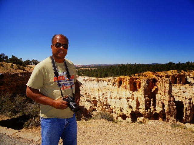
On August 15, we visited Bryce Canyon, Utah’s smallest National
Park. At 37,000 acres, it is about 18 miles long and 5 miles across at its widest. Geologically
Bryce Canyon is not really a canyon but a series of natural bowls. The soil
here is finer that than in the Zion NP and more easily erodible into finlike
walls, spires and pinnacles. They call some of the pinnacles "hoodoos," which we though was an interesting name.
Near the entrance to Bryce is Red Canyon in Dixie National Forest. I had spent time working in this National Forest while assigned to the the Regional Office of the Forest Service out of Ogden, UT. I had never been to this fairly new visitor center. They had a book on the history of the Forest Service in their gift shop, and it had my picture in it. Of course Daisy showed the photo to the center's director, who came over to shake my hand and welcome me back to the Region.
 |
| Dixie NF Info center for Red Canyon |
 |
| Red Canyon at Dixie NF, near Bryce NP |
 |
| View from Bryce Point, elevation 8300 ft. |
 |
| Bryce Amphitheater |
 |
| Hat Shop |
 |
| Bryce Amphitheater |
A shuttle is required to travel in this NP due to very
limited places to park a large vehicle.
We parked outside the NP entrance to catch the shuttle. The pluses of using the shuttle were that I
got to see the park without having to watch out for oncoming traffic, and I was
also able to take pictures to supplement Daisy’s photography. We got off at various viewpoints on the 18-mile
park road, which follows the edge of the plateau. We were able to get some
fantastic views.
 |
| Inspiration Point Hoodoos |
 |
| Happy couple, with a view from 8100 feet |
 |
| Pretty as a picture |
 |
| Sunset Point |
Leaving Bryce heading to Capitol Reef:
 |
| First we go down in elevation.... |
 |
| Then we climb in elevation out of the arid brushy desert zone. |
 |
| Onto the high Alpine and aspen treed zone at 9600 feet. |
 |
| Did I mentioned it was steep at times? |
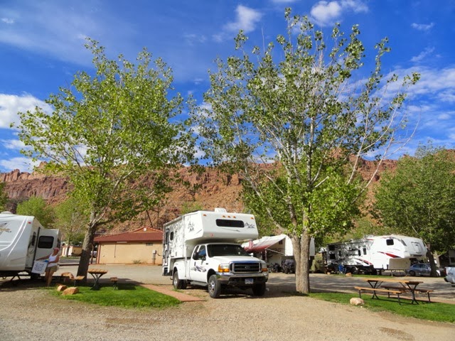
After our day of
touring, we stayed the night at Wonderland RV Park in Torrey, UT enroute to our
next stop–Capitol Reef National Park.
 |
| All kinds of campers use this place |
 |
| Individual showers with potties here |
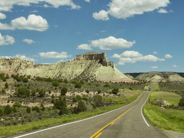
Capitol Reef National Park
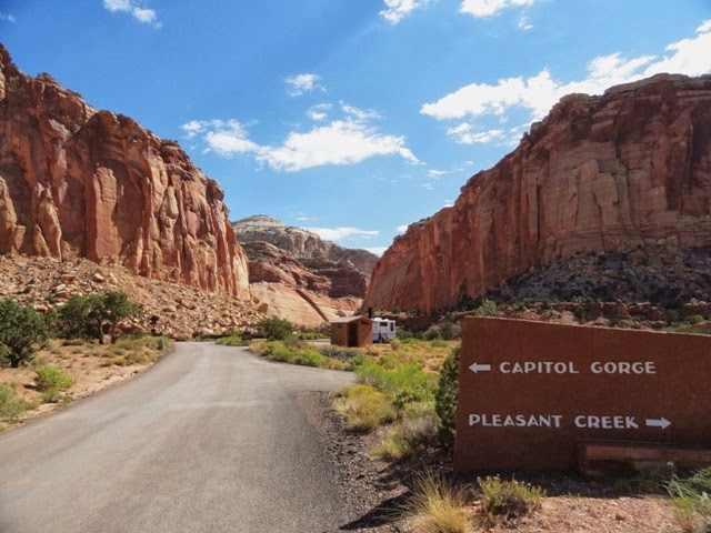
Capitol Reef was named by the Mormon settlers. The park is approximately 242,000 acres. The enormous conical sandstone domes, which rest atop a 100-mile long wrinkle (reef) in the Colorado plateau, reminded the early settlers of the U.S. Capitol.
 |
| The Castle from the visitor information center |
Unlike Zion and Bryce, there were no shuttle services. This park had very light traffic and numerous traffic signs warning visitors to stay out of the drivable low-water crossing areas if there are storms in the area. Thunderstorms were forecast for later on in the afternoon, but we were long gone by then.
 |
| Sandstone dome off in the distance |
 |
| The pause that refreshes...check for snakes first... |
 |
| Some of the roads we traveled on were gravel, dirt and narrow. |
 |
| Of course we did |
 |
| We are 26 ft |
 |
| Egyptian Temple | | | | | | | | | |
|
|
|
 | | | |
| Slickrock Divide |
 |
San Rafael Swell
Where water collected, there is evidence of homesteading by the earlier Mormon family groups. Lush orchards still exist. We were able to purchase fresh homemade fruit pies while we learned the history of these earlier hardy folk.

|

 |
| Historic Fruita Orchard and pasture |
Prior to the coming of the white men, the indigenous people who inhabited the area left their life stories carved in stone.
 |
| Petroglyph Panel |
Canyonlands National Park
We were able to visit Canyonland NP the same day. The sun would be setting and we hoped to get some interesting pictures later on at dusk. Canyonlands NP is approximately 337,000 acres and is Utah's largest National Park. It was once describe as a "wilderness of rocks and deep gorges where rivers are lost." It has also achieved notoriety as the place where Butch Cassidy and his gang hid out from the law. The vistas here are immense and overwhelming. Grand View allows a 100-mile wide panorama that was awesome to behold. If you have been to the Grand Canyon, you have a sense of that feeling here.

One surprise I got was not with pictures (the clouds did not cooperate) but of a human kind. In New Mexico I had developed a relationship with a young teenage boy in our church congregation. Robbie and I talked at length about what a forest ranger did and the schooling required for this career. When I moved away, I physically lost track of him, but knew he had gone to college and was now a national park ranger somewhere. Daisy and I went into the Canyonlands visitor center to get a map and...
 |
| One old forest ranger meets a young park ranger. |
 |
| I met him by surprise here. |
 |
| Grand View Point at 6,080 feet, with the Green River below |
 |
| The Colorado River has cut so deep it can not be seen |
 |
| Monument Valley |
 |
| Grand View Point |
 |
| One beautiful view... |
 |
| deserves another beautiful view. |
 |
| We got here just before dusk in Moab UT |
 |
| We were parked near to restrooms and showers |
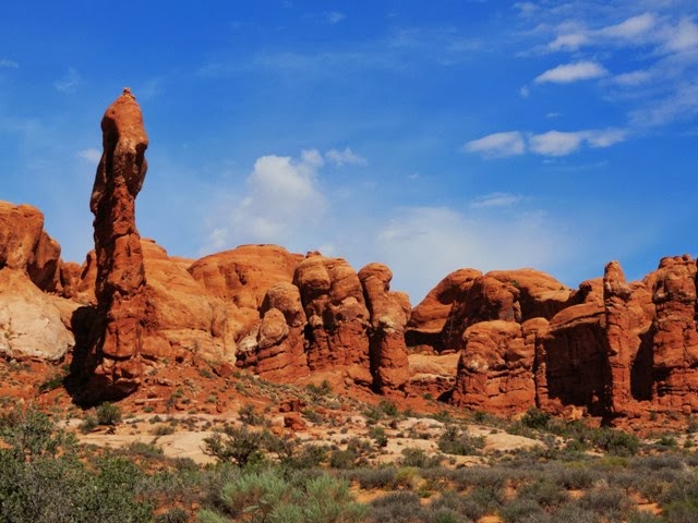
Arches National Park
Arches National Park has a different kind of beauty. It is 73,000 acres and has over 2,000 natural arches, with hundreds of balanced rocks and other formations. We hiked to see a few of these features, which are in all cases fragile. In 2007, I had gone to Arches NP with a friend and hiked to the Devils Garden to see Wall Arch. The next year 2008, Wall Arch, a 71 foot wide and 33 foot high arch, collapsed. An interesting side note is that it collapsed on my birthday, August 4.
 |
| I had been here before, but Daisy had not. |
 |
| Looking up from the visitor center |
 |
| We are going up there |
 |
| Park Avenue |
 |
| Courthouse Towers |
 |
| The Garden of Eden |
 |
| Balanced Rock |
 |
| The Windows |
 |
| Double Arch |
 |
| People look very small in the center at the bottom. The arch is 114 feet wide and 112 feet high. |
A unique feature of these rock formations is that many are visible from the main road or after only a short hike. It is worth the walk to stand right next to these structures.
 |
| The Three Gossips |
 |
| Heading east out of Arches to Colorado |
This was my third visit to Arches National Park. My first was with my kids when they were in grade school. I am still awed by this place. It feels like a giant playground. I will bring my grand kids here too!
We left Moab, UT and Arches NP heading northeast up the Colorado River toward Glenwood Springs, Colorado and a new underground experience I will tell you about in the next blog.
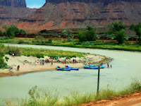 |
| We found floaters and OMG... |
 |
| a winery for a tasting experience in the early afternoon. |
With our backs to the park roads, we bid a fond farewell to the five National Parks of Southern Utah.
We found out later that we had taken over 1,200 pictures--thank goodness for digital cameras. But even the best photographs can't do justice to the spectacular landscapes and formations of these natural wonders. We are blessed to have the time and resources to explore our beautiful nation.
The open road beckoned. Our next stops were in Colorado, Wyoming, Nebraska, and Kansas.
Come go with us


No comments:
Post a Comment